A few inches in the wrong direction can cause real problems on a busy jobsite. A road set at the wrong grade or a utility line placed too high can affect the work around it. Even a small mistake can mean digging again or fixing work that was already completed. Getting the measurements right from the start can save a lot of trouble later.
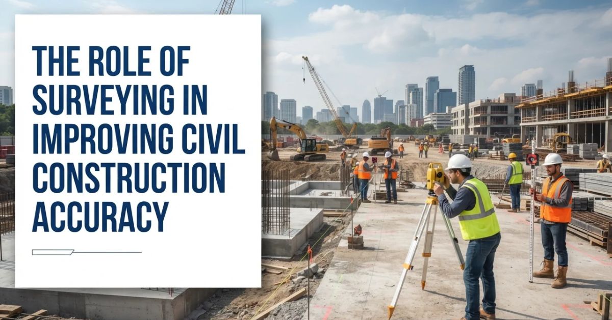
Surveying gives crews the measurements they need throughout civil construction. At J.E. Shurden Construction, those measurements help crews know where to dig, grade, place utilities, and build roads. Surveyors also check elevations and locations as work moves across the site. This helps each part of the job line up with the project plans.
What Surveying Actually Does on a Construction Site
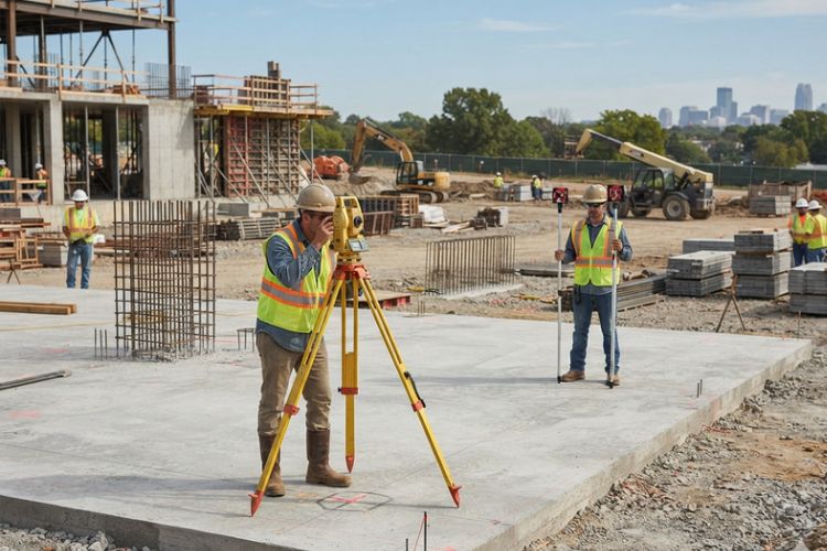
Before crews start digging or moving dirt, they need to know exactly what they are working with. A civil site survey maps out important details such as property boundaries, ground elevations, slopes, and reference points across the site.
These measurements give crews clear marks to follow once work gets underway. They support construction accuracy by helping operators know where to excavate, how much soil to move, where utilities belong, and what elevations need to be reached.
Turning Engineering Plans Into Work on the Ground
Engineering drawings show where everything should go, but crews still need those details marked out on the actual jobsite. Surveying turns the measurements on the plans into points and markings crews can follow while they work. This helps them know where to dig, where a road should run, or where utilities need to be placed. It makes the drawings useful out in the field.
Construction Staking Marks Where Work Belongs
Stakes, offsets, centerlines, and other field markings show crews where specific features should be built. This construction layout can guide excavation limits, utility alignments, road centerlines, building areas, and other planned improvements.
Clear layout information also gives equipment operators and supervisors something measurable to check against. That becomes increasingly important when several types of work are happening across the same property.
Elevations Matter Just as Much as Location
Knowing where something belongs is only part of the job. Crews also need to know how high or low it should be, especially when working with finished grades, roads, building pads, drainage features, and underground utilities.
Proper elevation control helps keep work closer to the engineered design. It can also prevent problems that may not become obvious until another phase of civil construction has already started.
Where Survey Accuracy Matters Most
Surveying affects many parts of a heavy civil project, but some operations depend especially heavily on precise location and elevation information. Errors in these areas can carry forward and affect surrounding work.
Earthwork and Grading
Grading starts with knowing how much dirt needs to move and where it needs to go. Survey measurements show crews where the ground is too high, where it is too low, and what the finished grade should be once the work is done.
This can keep crews from digging too deep or hauling in fill that was not needed. A civil construction company Mississippi property owners choose can use these measurements while grading large areas, shaping slopes, and preparing the site for the work that follows.
Drainage, Roads, and Utilities
Few inches can change how water moves across a site. If a ditch, culvert, or swale sits too high or too low, water can collect in the wrong place. Surveying helps crews check these elevations before the work goes any further.
Roads and utility lines also have to be set at the right height and depth. Crews use measurements to know where a road should sit and how deep a utility line needs to go. Getting that right early can save them from digging things up and doing the work again later.
Catching a Measurement Problem Before It Becomes Rework
Surveying is useful not only for establishing work but also for checking it. Finding an incorrect grade shortly after excavation is usually easier to address than discovering it after aggregate, pavement, utilities, or other improvements have been installed.
Good construction accuracy can reduce unnecessary excavation, backfilling, material use, and corrective work. It also helps prevent one misplaced feature from interfering with another part of the project later.
Routine checks give project teams a chance to compare field conditions with design information as work moves forward. This is one reason surveying remains involved beyond initial site preparation.
Surveying Continues as the Site Changes
A construction site does not stay the same for long. Excavation changes elevations, utilities disappear underground, roads take shape, and permanent improvements gradually replace the original ground conditions.
Checking Work Between Major Phases
Crews can check measurements as the job moves from one stage to the next. This gives them a chance to catch a grade, line, or location that is off before more work goes on top of it. It matters even more for utility lines and other work that will soon be buried or covered. Once that happens, fixing a mistake can mean digging everything back up.
A second civil site survey or targeted verification may also be needed when field conditions differ from the plans. Having current information gives engineers and crews a better basis for deciding how to proceed.
Recording What Was Actually Built
As-built surveying shows where things ended up once the work is finished. It records final locations and elevations so owners, engineers, and maintenance crews have a clear record. This information can also come in handy when more work is planned on the site later.
This is especially useful for underground utilities and other parts of Civil Infrastructure that will eventually be covered. Once pipes, lines, and other features are buried, it can be hard to know exactly where they are. Having their locations recorded can save time and guesswork later.
Modern Tools Make Field Measurements Faster
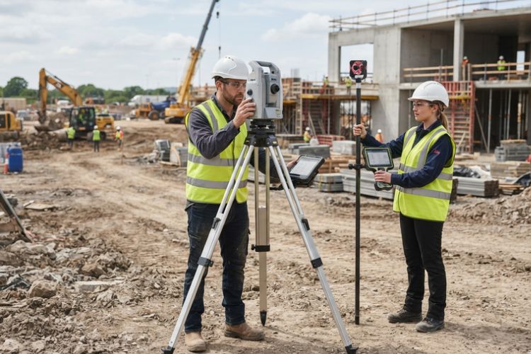
Surveyors now have tools that make many jobs in the field quicker than they used to be. Total stations, GNSS receivers, robotic systems, and data collectors can take and record measurements without crews having to do every step by hand.
Modern survey equipment also makes it easier to carry measurements from the field into project files. Crews can use that information when marking locations, checking elevations, or confirming completed work. This can save time when measurements need to be taken across a large site.
Good Equipment Still Needs to Be Set Up Right
Even the best equipment can give crews the wrong information if it is not set up correctly. Surveyors still need reliable control points, the right project data, and a clear understanding of the site before taking measurements.
Regular checks also matter when using survey equipment throughout a project. Instruments may need to be checked or calibrated, especially when they are moved around a busy jobsite. The tools can make the work faster, but surveyors still need to make sure the numbers they are working with are right.
The Field Team Needs to Work From the Same Information
A survey can be done correctly, but problems can still happen if someone on the job is working from an older drawing. Surveyors, engineers, supervisors, and equipment operators all need to know when plans have been changed and which version they should be following.
This matters even more when the construction layout changes after work has already started. A new elevation, location, or dimension needs to reach the crew before they continue digging, grading, or placing materials. Otherwise, work may have to be corrected later.
The same applies across different parts of civil construction. Grading can affect drainage, utility locations can affect roadwork, and elevations in one area can affect another. Keeping everyone on the same set of plans makes it easier for each crew to do its part without creating problems for the next one.
Conclusion
Surveying is part of the job from the first day on site to the last. Crews use it to know where roads, utilities, drainage areas, and finished grades need to go. Regular measurements can spot something that is off before more work is built around it.
Good survey information also helps different parts of civil construction fit together as planned. Crews can check locations and elevations before moving ahead with grading, utilities, roads, or drainage work. When measurements are right, there is less chance of having to go back and redo completed work. That helps keep the job moving from one stage to the next.
FAQs
What is surveying in civil construction?
Surveying helps crews understand exactly where work needs to happen on a site. It provides measurements for locations, boundaries, ground levels, and other important points. Crews use these details when grading land, building roads, digging for utilities, and carrying out other sitework.
Why are control points important on a construction site?
Control points give surveyors a fixed place to measure from as work moves around the site. They make it easier to check whether roads, utilities, grades, and other features are being placed in the right location. Without dependable control points, keeping measurements consistent across a large site becomes much harder.
How does surveying help with grading?
Survey measurements show existing and proposed elevations. Grading crews can use this information to determine where cuts or fills are needed and check whether finished slopes and elevations match the plans.
How can surveying reduce construction rework?
Surveying allows important locations and elevations to be checked before later work covers them. Finding a problem earlier can reduce the amount of material, labor, and completed construction that needs to be corrected.